
Parallelizing TimeGeo for Scalable Urban Mobility Simulations
TimeGeo is a data-driven framework for simulating individual urban mobility using sparse spatiotemporal data (e.g. LBS: Location Based Services data), enabling high-resolution insights without traditional surveys. Originally designed for memory efficiency, TimeGeo requires faster computation to scale to realistic, city-wide applications. In this work, we focus on parallelizing two core modules - Stay Detection, which processes raw LBS data, and Parameter Generation, which defines user-specific behavioral parameters. By distributing computation across multiple processing units and incorporating waiting mechanisms to maintain accuracy, we significantly reduce runtime and improve scalability, making TimeGeo more practical for real-time and high-resolution urban mobility analysis.
Text
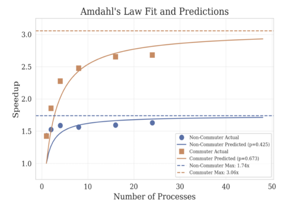
Figure: Amdahl's Law for Parallelizing the TimeGeo Algorithm
Dynamic Pricing & Matching Policies for Ridesharing
This study analyzes Chicago's ride-sharing data, exploring pricing, rider willingness to pay, and wait times. High-demand areas near Downtown Chicago contrast with sporadic outskirts demand, influencing pricing strategies. We develop a nuanced pricing policy, considering system states and potential rider matches. Dispatch decisions rely on the likelihood of successful matches, resorting to solo dispatches under certain conditions. Our policies aim for profitability amid dynamic system states characterized by riders' willingness to pay, their maximum waiting times, and different ride locations.
Text | Code
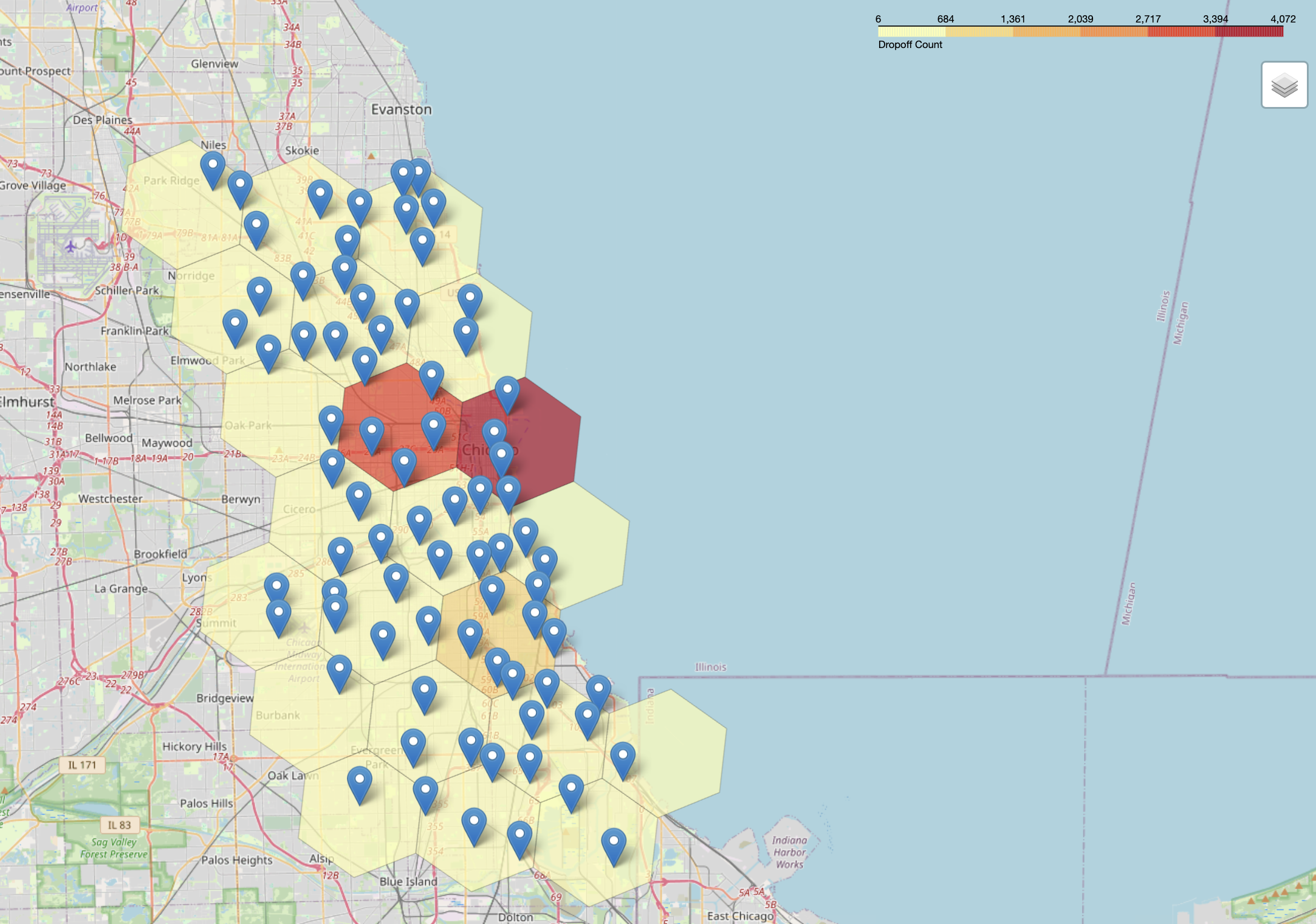
Figure: Pickup Count in Chicago
Modeling the Dynamics of City-Centers
Modern urban forms can be broadly categorized as monocentric, with a dominant city center, or polycentric, with multiple equally dominant centers of attraction. This work quantifies these forms using data from the state-of-the-art TimeGeo model, which includes LBS data for synthetic agents calibrated on real-world travel-demand data. We analyze the location data of various facilities, which indicates local attractiveness akin to a city center. Combining this with average daily travel distances, we propose metrics to assess monocentricism and polycentricism in two US cities: Boston and Los Angeles.
Text | Code
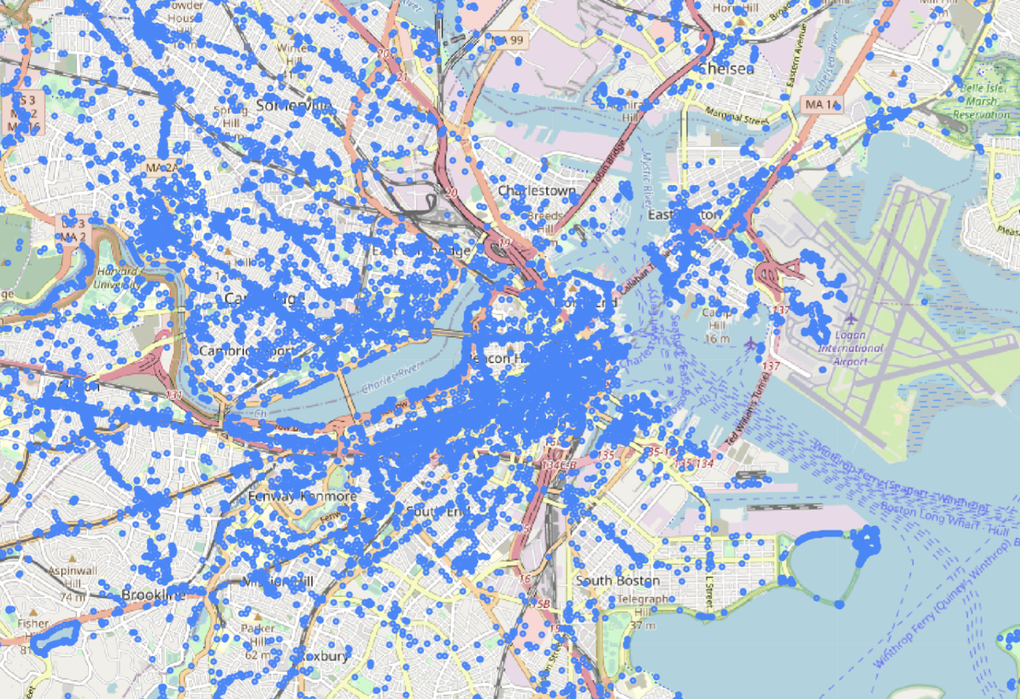
Figure: POI's in Boston